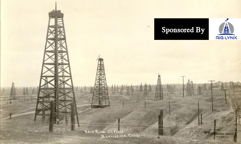
(Photo Source: Kern County Museum)
It took until 1920 for Conrad Schlumberger to publish the results of the experimental surface resistivity measurements he had carried out since 1911.
In the same year, Conrad and Marcel opened their first office at 30 rue Fabert in Paris.
Conrad’s focus on making geophysical measurements became all-consuming now, prompting him to resign his professorship at EÌcole de Mines, Paris in 1923.
Conrad and Marcel spent the next three years conducting geophysical surveys in Serbia, Canada, South Africa, Congo and the USA, as well as Romania, where they made the first mapping of an oil-productive salt dome using electrical prospecting.
In 1926, they created the SocieÌteÌ de Prospection EÌlectrique, or “Pros†as it was nicknamed—the forerunner of the Schlumberger company. Initially, the firm carried out surface prospecting for the metal ore mining industry but gradually extended its activities to embrace exploration of possible oil-bearing structures.
To better understand measurements made at the surface, the Schlumberger brothers needed to incorporate resistivity information from deeper formations. Conrad had the idea of measuring resistivity directly with an electrical probe, or sonde, run into boreholes drilled through the formations.
The first attempt to do this was made on September 5, 1927 by a team led by experimental physicist Henri Doll, Conrad’s son-in-law. Measurements were taken from an electrical sonde at various discrete depths in a 500-meter-deep well in Pechelbronn in the Alsace region of France. A new term was coined to describe the results of this multi-depth survey: it was called an electrical resistivity well log.
This first log was little more than a simple hand-plotted graph, but it marked a turning point in the history of oil exploration. Before then, engineers and scientists had to rely on core samples or cuttings brought up from boreholes to assess the composition of subsurface rocks. But the indications these gave were highly unreliable and frequently missed oil zones. The log showed that electrical measurements taken in boreholes could help identify the geological formations around them. It effectively enabled people to “see†what was down the well—and because the resistivity recordings proved to be repeatable in neighboring wells, it was possible to enable precise correlation of formations across an entire field.
International demand for the process, also known as “electrical coring,†grew rapidly. By 1929, sub-surface logs were being run in Argentina, Ecuador, India, Japan, the Soviet Union, Venezuela and the USA.
More patents were filed around the world, ensuring that the intellectual property of Schlumberger products was secured early.
1920
- The Schlumberger brothers open their first office at 30 rue Fabert in Paris
1923
- The Schlumberger brothers begin conducting geophysical surveys in Romania, Serbia, Canada, Union of South Africa, Belgian Congo and the USA
- Mapping of the first oil-productive salt dome by electric prospecting in Romania
1926
- Formation of SocieÌteÌ de Prospection EÌlectrique (Pros), the precursor of Schlumberger
1927
- Henri-Georges Doll joins the company, initially part-time
- Doll and his team record the first electrical resistivity well log in Pechelbronn, France
1929
- Subsurface surveying is carried out in Argentina, Ecuador, India, Japan, the Soviet Union, Venezuela and the USA
- The USA’s first ever well log is performed in Kern County, California
Read more about Schlumberger Here
Before there were highways, railways and canals, before Kern County was California’s leader in oil production and an agricultural center, even before there was even a United States.
There were Spanish Explorers criss-crossing the Western United States and in 1772 the first non-Indian man to visit Kern County was the then Governor of Alta California, Pedro Fages, who in 1772 used Grapevine Canyon to head from San Diego to San Luis Obispo en route to Monterey.
But the real first explorer of the county, is a familiar name, Padre Francisco Garces, yes that Garces. The high school was named after him in 1947, but his major expedition in the county began in April 1776 and with the help of State Historical Landmarks, we can follow his 18th century travels today.
Garces was in search of the best route from Sonora, Mexico to Monterey, California and Garces’ first stop in the San Joaquin Valley was along Bear Mountain Boulevard in Arvin.
In the shadow of St. Thomas the Apostle Church is a small memorial to Garces. It reads, in part, “This epic journey covered more than 2,000 miles of uncharted desert and wilderness, opening trails later to become highways and railways.â€
His next stop was north, where along Highway 178 between Commanche and Rancheria Roads, sits another State Historic Landmark highlighting his crossing of the Kern River on May 1, 1776, of course he named the river “Rio de San Felipe.â€
While we don’t know the exact spot along the Kern River where Garces crossed, we do know where he went in 1776, north towards what is present day Woody.
Two days after crossing the river, Garces was about eight miles west of Woody along Highway 155 on May 3, 1776, when he baptized a dying Yokuts Indian boy.
But the landmark has clearly seen better days, as the plaque detailing the valley’s first Christian Baptism is missing.
According to the State Office of Historic Preservation, itÂ’s unfortunately all too common. Such markers are funded only by private means not the state and it could cost as much as $3,000 to replace.
From the aptly named Garces Highway our journey concludes at the most well known monument built in his honor.
The Garces Circle is the approximate site of a Yokuts Indian Rancheria Garces visited. A spot Garces named “San Miguel de Los Noches Por el Santa Principe.â€
While our journey lasted just a few hours, it took Garces about a week on this path to be the first to explore Kern County.
Check out our other current stories, we dare you…
Â


